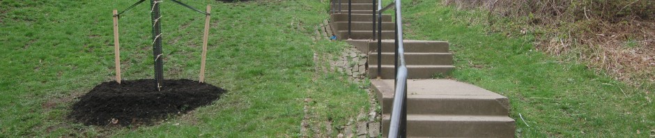
Make a left and descend these 72 serpentine steps, grouped together in sets of three. In the hill to the right are trails created as part of the South Side Park development. Come back and discover at your leisure. At the bottom of the steps, follow the paved road on left down to the registration area where you started. From the registration area you can join the Black Route. Please see map and directions.
StepTrek Route: Gold Route 2018
Gold Route 2018
-
South Side Park, Saber Way
Make left and walk down Saber Way into park. Serpentine Steps are on your left before the parking lot.
-

S. 18th St.
Cross to opposite side and make right. Walk 40 feet to entrance to “South Side Park” at Saber Way.
-
Roscoe St.
At bottom of steps, cross lane and make right on Roscoe St. Ascend 9 steps on left side. In a half block is Crossman St.
-
Oporto St. Steps
Turn right. Begin descending the 115 steps to Roscoe St. To the right of the steps was the site of the Sankey brick yard that was active in the Slopes until the 1950s. Many a yard in the slopes has a stash of Sankey bricks buried under the soil.
-
Baldauf St.
Turn right and climb 5 steps to upper sidewalk on right. Notice the houses on the left sit below grade, a feature seen in this steeply sloped neighborhood. The lower sidewalk is their only point of access. Continue to the end of the street. Just past 1929 Baldauf, on the left, is a set of steps. Descend the 10 steps to Oporto St. Steps.
-
Yard Way
Make a left on Yard Way and walk to Shamokin St. View uptown, Oakland and Greenfield across the river. The South Side Works, on the site of the former LTV site, sits to the bottom right. The Yard Way steps, built in 1944, contain a total of 301 steps, and extend down to Pius St. Cross Shamokin and descend 63 steps to Winter’s Playground at Huron St. and another 52 steps to Baldauf St.
-
* Billy Buck Hill
Founded by Germans, the name Billy Buck comes from goats once kept in the yard of a local store. Bordered by cliffs and rugged terrain, the area is accessible by steps and a single street. According to the Pittsburgh Post-Gazette, a milk truck once flipped over while making deliveries on its hilly streets. Another time, a horse and wagon, hauling waste from neighborhood outhouses, tumbled over the hillside. The ball field on the left is at the summit of this steep hillside.
-
St. Paul St.
Make left. The orange brick building on the left is the St. Paul of the Cross Retreat Center, which is available for individual retreats by arrangement. Continue down the street to the brick walls that are part of the monastery. The walls appear to be the original ones that shielded the enclave from the outside world. Parts of the garden and its Stations of the Cross can be seen from either end of the wall. Follow St. Paul to Yard Way. Welcome to Billy Buck Hill!
