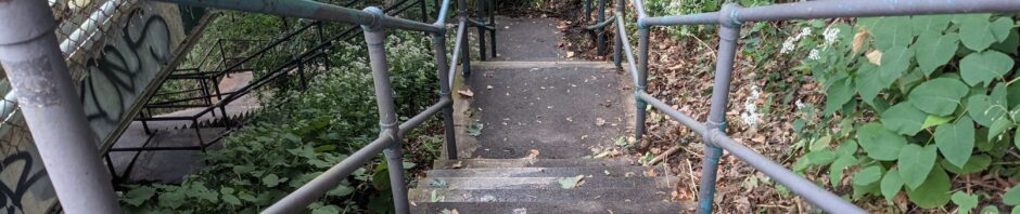
Mission St. Steps – Descend the steps behind the bus shelter on the left at S. 18th & Mission. These 102 steps drop down to S. 21st St. To return to the registration area, make a right at the bottom of the steps.
StepTrek Route: Black Route 2021
Black/East route 2021
-

Join Gold Route
To join Gold Route, cross S. 18th St. to Pius St. For more information, please see West Route map and narrative.
-

Mission St.
Make left. After the first bridge is the Mission St. pumping station circa 1900, which delivers water into the neighborhood and surrounding area. An initiative in 2009 brightened this area by replacing existing street lighting with higher wattage lamps. To continue to finish and Gold Route, cross the second bridge built in 1939 as a project of the Public Works Administration under FDR. That’s South Side Park below and rising up the hill to your left. Continue to S. 18th St. and Mission St. Steps.
-

* St. Josaphat Church
Dedicated in 1916, the Roman Catholic Church was built to serve a Polish parish established in 1901. The building is Romanesque with a Byzantium influence evident in the arches, pillars and bell tower. The main altar held relics of St. Josaphat. In the rear, beneath the choir balcony, hung a picture of the Black Madonna. The church closed permanently after a section of ceiling collapsed about the casket of the last caretaker during his funeral mass. The church is being converted into multiple living units. Many Polish descendents continue to inhabit this section of the Slopes. The names of relations and former residents who served in World Wars I & II are seen on the memorial tucked into the hillside across Mission St. from the church.
-
Sterling St. Steps
Descend an additional 63 steps to Mission St. To the left are views of downtown, the bridges and the rivers. Continue down to Mission Street.
-
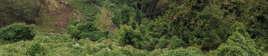
* South Side Park Trail System
The park on the left has trails designed and built in collaboration with the Student Conservation Association. Funded by a 2015 Birmingham Foundation grant, the trail connects the eastern and western halves of South Side Park. Landforce constructed both the Salisbury Connector Trail and Sterling Connector Trail in 2016. Goats from Allegheny Goatscape helped tame invasive vines this past summer. SCA and Slopes volunteers cleared a significant amount of land to cut across the steep terrain.
-

Sterling St. Steps
Built in 1951, the steps connect to Mission St. below. Take in the view of the Mon River, downtown and the rooftops of South Side. When ready, descend 92 steps to Wellington St. and an additional 132 steps to Holt St.
-

* Brashear Association, Kaufmann Neighborhood House
The Brashear Association was founded in 1917 to honor the renowned, self-taught scientist John A. Brashear and celebrate his humanitarianism. The Henry Kaufmann Neighborhood House was constructed in 1965 as an outreach site. Brashear Association supports and enriches families in a community context to build more vital lives and neighborhoods in South Pittsburgh. The building also houses Arlington Community Center.

