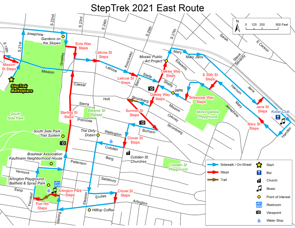
If joining from the Gold Route, begin here. * Denotes history or significant site.
If joining from the Gold Route, begin here. * Denotes history or significant site.
If joining from the Gold Route, begin here. * Denotes history or significant site.

To help celebrate StepTrek’s coming of age, five different bands will perform at various venues throughout South Side Slopes. Four of the bands boast members who live on the South Side Flats or Slopes. Performance locations and times are listed within the route narrative. Take time to enjoy a breather and some music!
To help celebrate StepTrek’s coming of age, five different bands will perform at various venues throughout South Side Slopes. Four of the bands boast members who live on the South Side Flats or Slopes. Performance locations and times are listed within the route narrative. Take time to enjoy a breather and some music!
To help celebrate StepTrek’s coming of age, five different bands will perform at various venues throughout South Side Slopes. Four of the bands boast members who live on the South Side Flats or Slopes. Performance locations and times are listed within the route narrative. Take time to enjoy a breather and some music!
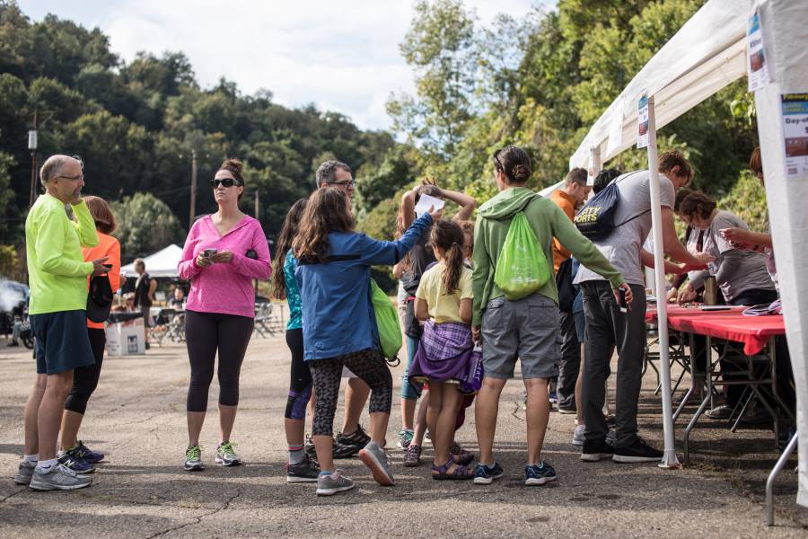
You are standing at the top of S. 21st St. in South Side Park. From StepTrek Marketplace and registration in South Side Park, walk down S. 21st St. to Josephine St. and make right.
You are standing at the top of S. 21st St. in South Side Park. From StepTrek Marketplace and registration in South Side Park, walk down S. 21st St. to Josephine St. and make right.
You are standing at the top of S. 21st St. in South Side Park. From StepTrek Marketplace and registration in South Side Park, walk down S. 21st St. to Josephine St. and make right.

Efforts continue to reclaim a 64 acre park that extends from Josephine St. below to the heights of the Slopes. In this wooded hillside are streams, ball fields and pathways. Volunteers have removed invasive knotweed and vines that choke the park and built its trails. With funding from The Brashear Association, SSSNA partnered with Pittsburgh Parks Conservancy, Landforce and the Student Conservation Association to create this neighborhood asset. Friends of South Side Park manage its ongoing work.
Efforts continue to reclaim a 64 acre park that extends from Josephine St. below to the heights of the Slopes. In this wooded hillside are streams, ball fields and pathways. Volunteers have removed invasive knotweed and vines that choke the park and built its trails. With funding from The Brashear Association, SSSNA partnered with Pittsburgh Parks Conservancy, Landforce and the Student Conservation Association to create this neighborhood asset. Friends of South Side Park manage its ongoing work.
Efforts continue to reclaim a 64 acre park that extends from Josephine St. below to the heights of the Slopes. In this wooded hillside are streams, ball fields and pathways. Volunteers have removed invasive knotweed and vines that choke the park and built its trails. With funding from The Brashear Association, SSSNA partnered with Pittsburgh Parks Conservancy, Landforce and the Student Conservation Association to create this neighborhood asset. Friends of South Side Park manage its ongoing work.
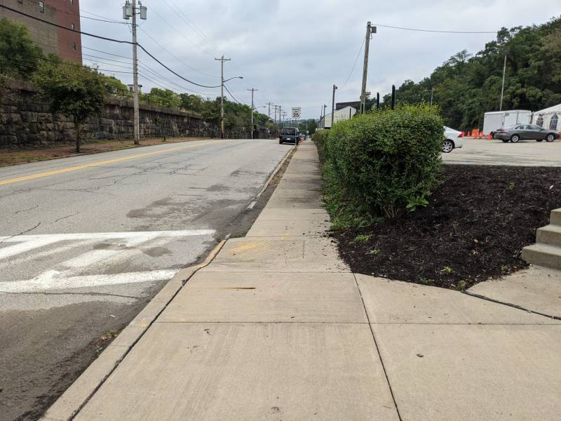
Make right and walk east toward S. 22nd St. Continue to Greeley St.
Make right and walk east toward S. 22nd St. Continue to Greeley St.
Make right and walk east toward S. 22nd St. Continue to Greeley St.
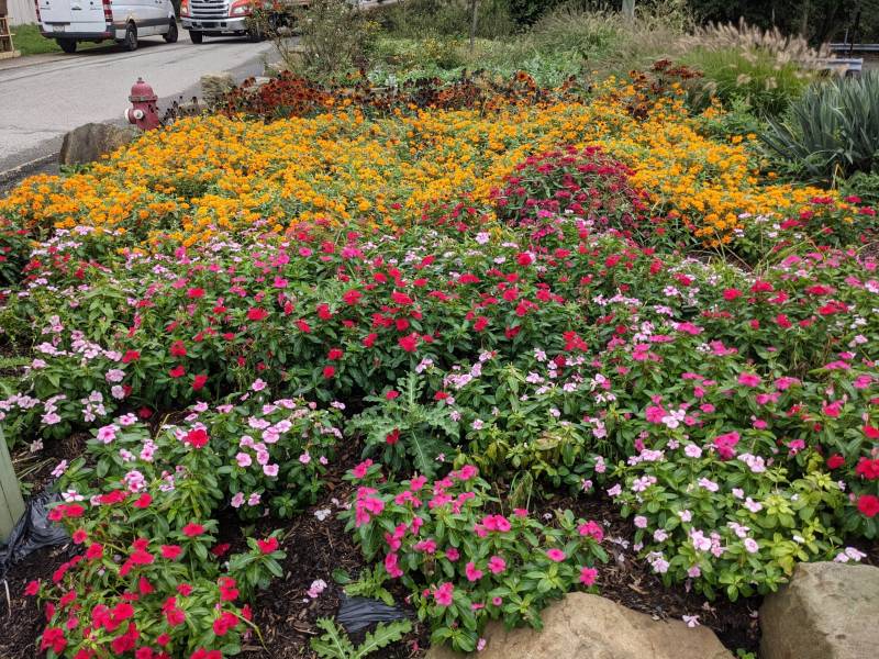
At the corner of Josephine & Greeley is the first of six gardens maintained by SSSNA members. Part of an effort to put a green face on the Slopes, the garden was first planted in 2002 in conjunction with the Western Penna. Conservancy.
At the corner of Josephine & Greeley is the first of six gardens maintained by SSSNA members. Part of an effort to put a green face on the Slopes, the garden was first planted in 2002 in conjunction with the Western Penna. Conservancy.
At the corner of Josephine & Greeley is the first of six gardens maintained by SSSNA members. Part of an effort to put a green face on the Slopes, the garden was first planted in 2002 in conjunction with the Western Penna. Conservancy.
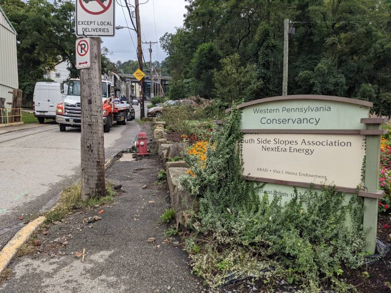
Turn right and continue up Greely 75 yards to Eola Way Steps on the left.
Turn right and continue up Greely 75 yards to Eola Way Steps on the left.
Turn right and continue up Greely 75 yards to Eola Way Steps on the left.

Make a left and walk to the stairs built in 1947. As you climb these 96 steps, each 4-ft wide, notice the ruins of stone or brick foundations perched over the hillside on the right. At the top of the steps is Leticoe St. and the back side of St. Josaphat Church.
Make a left and walk to the stairs built in 1947. As you climb these 96 steps, each 4-ft wide, notice the ruins of stone or brick foundations perched over the hillside on the right. At the top of the steps is Leticoe St. and the back side of St. Josaphat Church.
Make a left and walk to the stairs built in 1947. As you climb these 96 steps, each 4-ft wide, notice the ruins of stone or brick foundations perched over the hillside on the right. At the top of the steps is Leticoe St. and the back side of St. Josaphat Church.
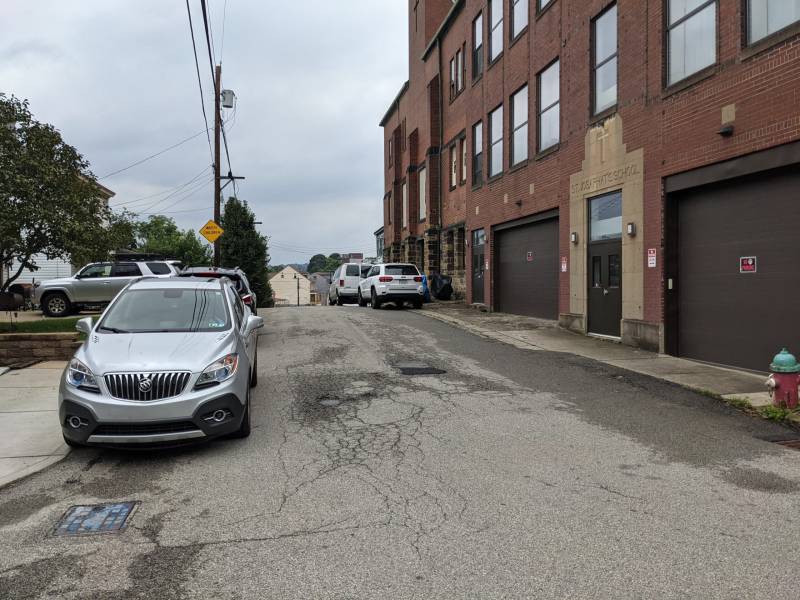
Make left and stay right as you descend Leticoe. At bottom of street, descend 23 steps where Eleanor St. meets Leticoe. Continue up Leticoe. In the 2500 block, just past the crest of the hill, look left to the houses tucked behind houses. Close quarters! Continue to Kosciusko Way, named for one of the Polish generals who assisted America in its War for Independence.
Make left and stay right as you descend Leticoe. At bottom of street, descend 23 steps where Eleanor St. meets Leticoe. Continue up Leticoe. In the 2500 block, just past the crest of the hill, look left to the houses tucked behind houses. Close quarters! Continue to Kosciusko Way, named for one of the Polish generals who assisted America in its War for Independence.
Make left and stay right as you descend Leticoe. At bottom of street, descend 23 steps where Eleanor St. meets Leticoe. Continue up Leticoe. In the 2500 block, just past the crest of the hill, look left to the houses tucked behind houses. Close quarters! Continue to Kosciusko Way, named for one of the Polish generals who assisted America in its War for Independence.
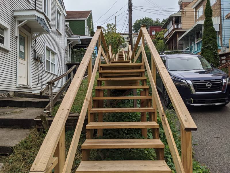
Located at the eastern terminus of Leticoe St., these 3-ft. wide wooden steps were rebuilt by the City of Pittsburgh in the summer of 2021. There are 69 steps. At the top cross Barry St. to Stella St.
Located at the eastern terminus of Leticoe St., these 3-ft. wide wooden steps were rebuilt by the City of Pittsburgh in the summer of 2021. There are 69 steps. At the top cross Barry St. to Stella St.
Located at the eastern terminus of Leticoe St., these 3-ft. wide wooden steps were rebuilt by the City of Pittsburgh in the summer of 2021. There are 69 steps. At the top cross Barry St. to Stella St.
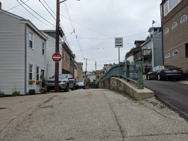
Go ahead . . . give it your best Marlon Brando: STELLA! Walk up Stella and keep to the right of the metal fencing that divides the road. In 1935 the Work Projects Administration (WPA) terraced this part of the hillside and created the bi-level street topped with an iron fence. In 1998 Pittsburgh History & Landmarks Foundation designated the Stella-Shelley fence as a historically significant landmark. Stay right on the upper level and walk to first set of steps.
Go ahead . . . give it your best Marlon Brando: STELLA! Walk up Stella and keep to the right of the metal fencing that divides the road. In 1935 the Work Projects Administration (WPA) terraced this part of the hillside and created the bi-level street topped with an iron fence. In 1998 Pittsburgh History & Landmarks Foundation designated the Stella-Shelley fence as a historically significant landmark. Stay right on the upper level and walk to first set of steps.
Go ahead . . . give it your best Marlon Brando: STELLA! Walk up Stella and keep to the right of the metal fencing that divides the road. In 1935 the Work Projects Administration (WPA) terraced this part of the hillside and created the bi-level street topped with an iron fence. In 1998 Pittsburgh History & Landmarks Foundation designated the Stella-Shelley fence as a historically significant landmark. Stay right on the upper level and walk to first set of steps.
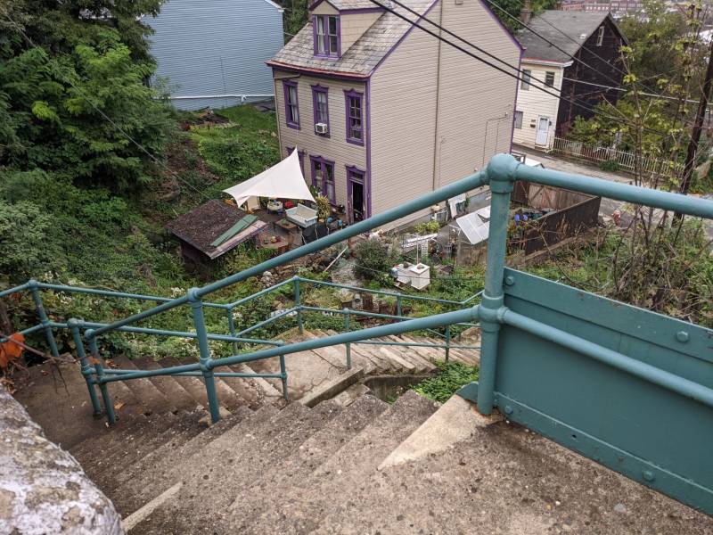
Make left. Descend 182 steps, built in 1928, pass McCord to Josephine. You are descending through a mosaic art installation. Stop to look back as you descent. Foundations of long gone houses sit to the right. A total of 289 steps, the equivalent of 12 floors, stretch from Josephine St. below to Sumner St. above.
Make left. Descend 182 steps, built in 1928, pass McCord to Josephine. You are descending through a mosaic art installation. Stop to look back as you descent. Foundations of long gone houses sit to the right. A total of 289 steps, the equivalent of 12 floors, stretch from Josephine St. below to Sumner St. above.
Make left. Descend 182 steps, built in 1928, pass McCord to Josephine. You are descending through a mosaic art installation. Stop to look back as you descent. Foundations of long gone houses sit to the right. A total of 289 steps, the equivalent of 12 floors, stretch from Josephine St. below to Sumner St. above.

The Oakley St. Steps mosaic was completed in 2016. The first of its kind in Pittsburgh, the installation was designed by artist Laura Jean McLaughlin, who led a group of 100 community volunteers in assembling the tiny mosaics on mesh. The finished panels cover 200 square feet and were mortared and grouted onto 77 risers. Led by SSSNA, the project was community-designed, funded and created.
The Oakley St. Steps mosaic was completed in 2016. The first of its kind in Pittsburgh, the installation was designed by artist Laura Jean McLaughlin, who led a group of 100 community volunteers in assembling the tiny mosaics on mesh. The finished panels cover 200 square feet and were mortared and grouted onto 77 risers. Led by SSSNA, the project was community-designed, funded and created.
The Oakley St. Steps mosaic was completed in 2016. The first of its kind in Pittsburgh, the installation was designed by artist Laura Jean McLaughlin, who led a group of 100 community volunteers in assembling the tiny mosaics on mesh. The finished panels cover 200 square feet and were mortared and grouted onto 77 risers. Led by SSSNA, the project was community-designed, funded and created.

Use take caution as you cross Josephine St. Continue down S. 27th St. to Mary St., located just before the railroad underpass.
Use take caution as you cross Josephine St. Continue down S. 27th St. to Mary St., located just before the railroad underpass.
Use take caution as you cross Josephine St. Continue down S. 27th St. to Mary St., located just before the railroad underpass.

Make right and stay on the sidewalk. You are now in the area known as the Hollow. Follow Mary to 2820 Mary St. and cross to Mary Jane St.
Make right and stay on the sidewalk. You are now in the area known as the Hollow. Follow Mary to 2820 Mary St. and cross to Mary Jane St.
Make right and stay on the sidewalk. You are now in the area known as the Hollow. Follow Mary to 2820 Mary St. and cross to Mary Jane St.
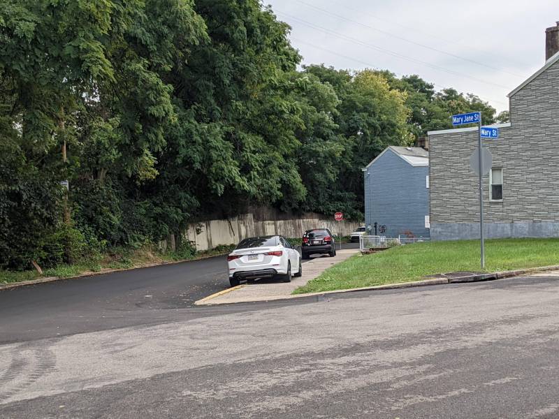
After the stop sign, stay right and continue along Mary Jane St. to Harcum Way.
After the stop sign, stay right and continue along Mary Jane St. to Harcum Way.
After the stop sign, stay right and continue along Mary Jane St. to Harcum Way.

Follow Harcum past S. 29th & S. 30th Sts. Though the sign ahead reads “No Outlet,” continue up slight grade past Print Shop Lofts. At the end of Harcum, follow the path cleared through this area for approximately 100 feet until you reach Jane St. steps.
Follow Harcum past S. 29th & S. 30th Sts. Though the sign ahead reads “No Outlet,” continue up slight grade past Print Shop Lofts. At the end of Harcum, follow the path cleared through this area for approximately 100 feet until you reach Jane St. steps.
Follow Harcum past S. 29th & S. 30th Sts. Though the sign ahead reads “No Outlet,” continue up slight grade past Print Shop Lofts. At the end of Harcum, follow the path cleared through this area for approximately 100 feet until you reach Jane St. steps.
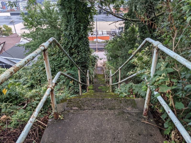
Make left and descend 78 steps to Jane St.
Make left and descend 78 steps to Jane St.
Make left and descend 78 steps to Jane St.

Make right. Continue one block to Handler St. On the right, before Handler, is the Kollar Club, where two of five bands are celebrating the 21st Annual StepTrek. Step inside for a drink, the restroom or to hear live music!
Make right. Continue one block to Handler St. On the right, before Handler, is the Kollar Club, where two of five bands are celebrating the 21st Annual StepTrek. Step inside for a drink, the restroom or to hear live music!
Make right. Continue one block to Handler St. On the right, before Handler, is the Kollar Club, where two of five bands are celebrating the 21st Annual StepTrek. Step inside for a drink, the restroom or to hear live music!

At 3226 Jane St., resides the John Kollar Slovak Literary & Library Society. Founded in 1913 and named for 19th Century Slovak poet, John Kollar, its original purpose was to teach English to Slovak immigrants and to orient them to life in America. The Pittsburgh Region is home to more Slovaks than any other area in the United States. The club continues in full operation preserving the Slovak language & culture, and serving as a social club and live-music venue. The Pump Fakes play from 11 a.m. to 1:30 p.m. Polkamaniacs play from 1:50 p.m. to 4 p.m.
At 3226 Jane St., resides the John Kollar Slovak Literary & Library Society. Founded in 1913 and named for 19th Century Slovak poet, John Kollar, its original purpose was to teach English to Slovak immigrants and to orient them to life in America. The Pittsburgh Region is home to more Slovaks than any other area in the United States. The club continues in full operation preserving the Slovak language & culture, and serving as a social club and live-music venue. The Pump Fakes play from 11 a.m. to 1:30 p.m. Polkamaniacs play from 1:50 p.m. to 4 p.m.
At 3226 Jane St., resides the John Kollar Slovak Literary & Library Society. Founded in 1913 and named for 19th Century Slovak poet, John Kollar, its original purpose was to teach English to Slovak immigrants and to orient them to life in America. The Pittsburgh Region is home to more Slovaks than any other area in the United States. The club continues in full operation preserving the Slovak language & culture, and serving as a social club and live-music venue. The Pump Fakes play from 11 a.m. to 1:30 p.m. Polkamaniacs play from 1:50 p.m. to 4 p.m.

Make right and keep right. There are five steps built into the sidewalk on the way to Mary St.
Make right and keep right. There are five steps built into the sidewalk on the way to Mary St.
Make right and keep right. There are five steps built into the sidewalk on the way to Mary St.

Make right and walk up Mary St. Steps.
Make right and walk up Mary St. Steps.
Make right and walk up Mary St. Steps.

Ascend 115 steps to reach upper Mary St.
Ascend 115 steps to reach upper Mary St.
Ascend 115 steps to reach upper Mary St.

Walk forward and descend Mary to S. 30th St. Steps.
Walk forward and descend Mary to S. 30th St. Steps.
Walk forward and descend Mary to S. 30th St. Steps.

Make left and ascend 108 steps to Josephine St.
Make left and ascend 108 steps to Josephine St.
Make left and ascend 108 steps to Josephine St.

Make right and drop down Josephine to Telescope St. Across and lining the uphill side of Josephine are the concrete walls of the former water reservoir that preceded Monongahela Park. Carefully cross at 2907 Josephine St. to reach Telescope St.
Make right and drop down Josephine to Telescope St. Across and lining the uphill side of Josephine are the concrete walls of the former water reservoir that preceded Monongahela Park. Carefully cross at 2907 Josephine St. to reach Telescope St.
Make right and drop down Josephine to Telescope St. Across and lining the uphill side of Josephine are the concrete walls of the former water reservoir that preceded Monongahela Park. Carefully cross at 2907 Josephine St. to reach Telescope St.
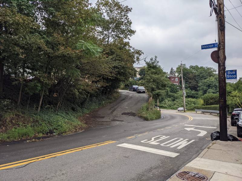
At the end of Telescope, ascend 56 steps to Shelly St.
At the end of Telescope, ascend 56 steps to Shelly St.
At the end of Telescope, ascend 56 steps to Shelly St.

Shelly St. is two levels here. On your left is an iron fence that divides the two sections. In 1935 the Work Projects Administration (WPA) terraced this part of the hillside and created the bi-level street topped with an iron fence. In 1998 Pittsburgh History & Landmarks Foundation designated the Stella-Shelley fence as a historically significant landmark.
Shelly St. is two levels here. On your left is an iron fence that divides the two sections. In 1935 the Work Projects Administration (WPA) terraced this part of the hillside and created the bi-level street topped with an iron fence. In 1998 Pittsburgh History & Landmarks Foundation designated the Stella-Shelley fence as a historically significant landmark.
Shelly St. is two levels here. On your left is an iron fence that divides the two sections. In 1935 the Work Projects Administration (WPA) terraced this part of the hillside and created the bi-level street topped with an iron fence. In 1998 Pittsburgh History & Landmarks Foundation designated the Stella-Shelley fence as a historically significant landmark.

Make right and walk to end of street. Walk up to Stella St. where it says “Do Not Enter.” The sign does not apply to StepTrekkers.
Make right and walk to end of street. Walk up to Stella St. where it says “Do Not Enter.” The sign does not apply to StepTrekkers.
Make right and walk to end of street. Walk up to Stella St. where it says “Do Not Enter.” The sign does not apply to StepTrekkers.

Continue west on Stella to Oakley Way Steps.
Continue west on Stella to Oakley Way Steps.
Continue west on Stella to Oakley Way Steps.

Ascend these 98 steps to Mission St. Climb an additional 19 steps to Stromberg St. on the right. The steps are part of the 289 steps, built in 1928.
Ascend these 98 steps to Mission St. Climb an additional 19 steps to Stromberg St. on the right. The steps are part of the 289 steps, built in 1928.
Ascend these 98 steps to Mission St. Climb an additional 19 steps to Stromberg St. on the right. The steps are part of the 289 steps, built in 1928.
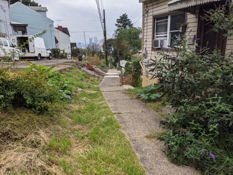
Make right. At end of street, take in the view of S. 10th St. Bridge and downtown. Keep left and walk along the chain link fence that wraps the house on the left. Make left on foot path and continue left to Sumner St.
Make right. At end of street, take in the view of S. 10th St. Bridge and downtown. Keep left and walk along the chain link fence that wraps the house on the left. Make left on foot path and continue left to Sumner St.
Make right. At end of street, take in the view of S. 10th St. Bridge and downtown. Keep left and walk along the chain link fence that wraps the house on the left. Make left on foot path and continue left to Sumner St.

Make left and walk up 30 steps to Oakley Way. Cross Oakley Way and continue up sidewalk to left of Sumner. Rebuilt in 2012, the concrete walk continues below grade. Note these homes sit below street level. Sets of wooden steps rise to the street. It’s a feature of streets scattered about the Slopes. Look back and take in the view of downtown. Here, the lots start to widen into yards with gardens and fruit trees. Climb 17 steps to 2725 Sumner. Make right and ascend 9 wooden steps. Cross to Burham St.
Make left and walk up 30 steps to Oakley Way. Cross Oakley Way and continue up sidewalk to left of Sumner. Rebuilt in 2012, the concrete walk continues below grade. Note these homes sit below street level. Sets of wooden steps rise to the street. It’s a feature of streets scattered about the Slopes. Look back and take in the view of downtown. Here, the lots start to widen into yards with gardens and fruit trees. Climb 17 steps to 2725 Sumner. Make right and ascend 9 wooden steps. Cross to Burham St.
Make left and walk up 30 steps to Oakley Way. Cross Oakley Way and continue up sidewalk to left of Sumner. Rebuilt in 2012, the concrete walk continues below grade. Note these homes sit below street level. Sets of wooden steps rise to the street. It’s a feature of streets scattered about the Slopes. Look back and take in the view of downtown. Here, the lots start to widen into yards with gardens and fruit trees. Climb 17 steps to 2725 Sumner. Make right and ascend 9 wooden steps. Cross to Burham St.

Continue along Burham to Clover St. Notice views to right of Uptown and Oakland across the Mon River.
Continue along Burham to Clover St. Notice views to right of Uptown and Oakland across the Mon River.
Continue along Burham to Clover St. Notice views to right of Uptown and Oakland across the Mon River.
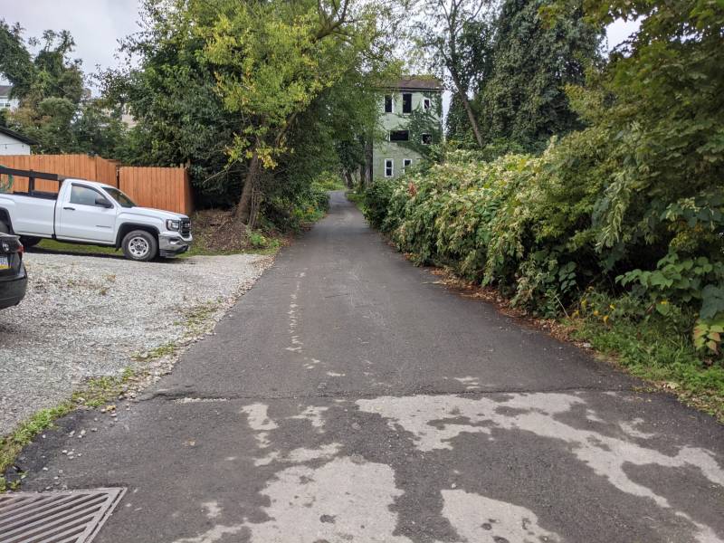
Make left and climb one block to Wellington St. and Clover St. Steps.
Make left and climb one block to Wellington St. and Clover St. Steps.
Make left and climb one block to Wellington St. and Clover St. Steps.
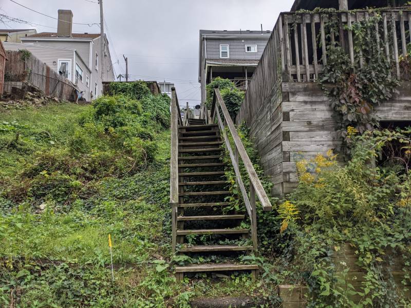
Ascend 51 steps to Cobden St.
Ascend 51 steps to Cobden St.
Ascend 51 steps to Cobden St.

In this section of the Slopes are a couple of smaller churches. Cobden Street Baptist Church is on the left corner at 2500 Cobden St. The Second Primative Methodist Church is at 2430 Cobden St.
In this section of the Slopes are a couple of smaller churches. Cobden Street Baptist Church is on the left corner at 2500 Cobden St. The Second Primative Methodist Church is at 2430 Cobden St.
In this section of the Slopes are a couple of smaller churches. Cobden Street Baptist Church is on the left corner at 2500 Cobden St. The Second Primative Methodist Church is at 2430 Cobden St.

Make right. The course takes you along the spine of a knoll, with yards sloping down on either side. Look between homes on right for views of Oakland. Continue to Eleanor St.
Make right. The course takes you along the spine of a knoll, with yards sloping down on either side. Look between homes on right for views of Oakland. Continue to Eleanor St.
Make right. The course takes you along the spine of a knoll, with yards sloping down on either side. Look between homes on right for views of Oakland. Continue to Eleanor St.

Each October, Pittsburgh cycling enthusiasts host a 50-mile bike race that goes up 13 of its steepest hills. Eleanor St. is one of the Dirty Dozen.
Each October, Pittsburgh cycling enthusiasts host a 50-mile bike race that goes up 13 of its steepest hills. Eleanor St. is one of the Dirty Dozen.
Each October, Pittsburgh cycling enthusiasts host a 50-mile bike race that goes up 13 of its steepest hills. Eleanor St. is one of the Dirty Dozen.
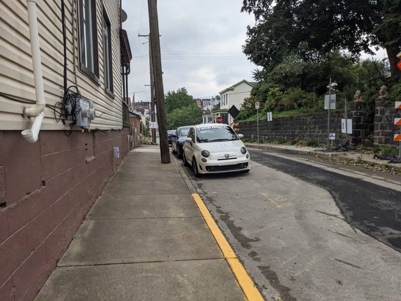
Make left. Keep left and continue up Eleanor past Salisbury St. to Eccles St.
Make left. Keep left and continue up Eleanor past Salisbury St. to Eccles St.
Make left. Keep left and continue up Eleanor past Salisbury St. to Eccles St.

Turn left. Walk one block to Clover St. Steps.
Turn left. Walk one block to Clover St. Steps.
Turn left. Walk one block to Clover St. Steps.

Take right and ascend 103 steps to Arlington Ave.
Take right and ascend 103 steps to Arlington Ave.
Take right and ascend 103 steps to Arlington Ave.

Make right. Walk three blocks to Sterling St.
Make right. Walk three blocks to Sterling St.
Make right. Walk three blocks to Sterling St.
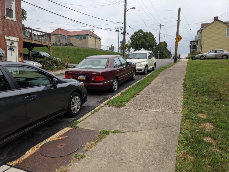
Make right. Walk past Fort Hill St. to steps on far side of yellow brick building.
Make right. Walk past Fort Hill St. to steps on far side of yellow brick building.
Make right. Walk past Fort Hill St. to steps on far side of yellow brick building.

Make left and ascend 12 steps to Arlington Park.
Make left and ascend 12 steps to Arlington Park.
Make left and ascend 12 steps to Arlington Park.

For all its steepness, there are playgrounds and ball fields throughout the Slopes. This ballfield regularly hosts baseball and softball games under the lights which can be seen from the South Side Flats and Oakland. Take in views of downtown’s tallest buildings and Oakland’s medical complex. The Spray Park opened in 2018. Replacing a deteriorated city pool, the spray functions are many and varied. A new children’s playground is under construction within the park. Keep left and walk along edge of park. Muscle of Love plays from 10:45 a.m. to 12:50 p.m. GutterRich plays from 12:50 to 2:15 p.m. Phat Man Dee performs from 2:15 to 4 p.m. with Christine Andrews belly dancing.
For all its steepness, there are playgrounds and ball fields throughout the Slopes. This ballfield regularly hosts baseball and softball games under the lights which can be seen from the South Side Flats and Oakland. Take in views of downtown’s tallest buildings and Oakland’s medical complex. The Spray Park opened in 2018. Replacing a deteriorated city pool, the spray functions are many and varied. A new children’s playground is under construction within the park. Keep left and walk along edge of park. Muscle of Love plays from 10:45 a.m. to 12:50 p.m. GutterRich plays from 12:50 to 2:15 p.m. Phat Man Dee performs from 2:15 to 4 p.m. with Christine Andrews belly dancing.
For all its steepness, there are playgrounds and ball fields throughout the Slopes. This ballfield regularly hosts baseball and softball games under the lights which can be seen from the South Side Flats and Oakland. Take in views of downtown’s tallest buildings and Oakland’s medical complex. The Spray Park opened in 2018. Replacing a deteriorated city pool, the spray functions are many and varied. A new children’s playground is under construction within the park. Keep left and walk along edge of park. Muscle of Love plays from 10:45 a.m. to 12:50 p.m. GutterRich plays from 12:50 to 2:15 p.m. Phat Man Dee performs from 2:15 to 4 p.m. with Christine Andrews belly dancing.
At end of park, keep left and descend the 49 steps to Fernleaf St.
At end of park, keep left and descend the 49 steps to Fernleaf St.
At end of park, keep left and descend the 49 steps to Fernleaf St.

Make right. On the left is former Engine House #22 which was established in 1894. Ahead at the intersection with Salisbury is the Brashear Association's Kaufmann Neighborhood House.
Make right. On the left is former Engine House #22 which was established in 1894. Ahead at the intersection with Salisbury is the Brashear Association's Kaufmann Neighborhood House.
Make right. On the left is former Engine House #22 which was established in 1894. Ahead at the intersection with Salisbury is the Brashear Association's Kaufmann Neighborhood House.

The Brashear Association was founded in 1917 to honor the renowned, self-taught scientist John A. Brashear and celebrate his humanitarianism. The Henry Kaufmann Neighborhood House was constructed in 1965 as an outreach site. Brashear Association supports and enriches families in a community context to build more vital lives and neighborhoods in South Pittsburgh. The building also houses Arlington Community Center.
The Brashear Association was founded in 1917 to honor the renowned, self-taught scientist John A. Brashear and celebrate his humanitarianism. The Henry Kaufmann Neighborhood House was constructed in 1965 as an outreach site. Brashear Association supports and enriches families in a community context to build more vital lives and neighborhoods in South Pittsburgh. The building also houses Arlington Community Center.
The Brashear Association was founded in 1917 to honor the renowned, self-taught scientist John A. Brashear and celebrate his humanitarianism. The Henry Kaufmann Neighborhood House was constructed in 1965 as an outreach site. Brashear Association supports and enriches families in a community context to build more vital lives and neighborhoods in South Pittsburgh. The building also houses Arlington Community Center.

Turn right.
Turn right.
Turn right.

Make left and descend past Patterson St. There are 8 steps built into the sidewalk.
Make left and descend past Patterson St. There are 8 steps built into the sidewalk.
Make left and descend past Patterson St. There are 8 steps built into the sidewalk.

Built in 1951, the steps connect to Mission St. below. Take in the view of the Mon River, downtown and the rooftops of South Side. When ready, descend 92 steps to Wellington St. and an additional 132 steps to Holt St.
Built in 1951, the steps connect to Mission St. below. Take in the view of the Mon River, downtown and the rooftops of South Side. When ready, descend 92 steps to Wellington St. and an additional 132 steps to Holt St.
Built in 1951, the steps connect to Mission St. below. Take in the view of the Mon River, downtown and the rooftops of South Side. When ready, descend 92 steps to Wellington St. and an additional 132 steps to Holt St.
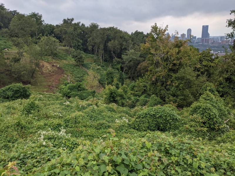
The park on the left has trails designed and built in collaboration with the Student Conservation Association. Funded by a 2015 Birmingham Foundation grant, the trail connects the eastern and western halves of South Side Park. Landforce constructed both the Salisbury Connector Trail and Sterling Connector Trail in 2016. Goats from Allegheny Goatscape helped tame invasive vines this past summer. SCA and Slopes volunteers cleared a significant amount of land to cut across the steep terrain.
The park on the left has trails designed and built in collaboration with the Student Conservation Association. Funded by a 2015 Birmingham Foundation grant, the trail connects the eastern and western halves of South Side Park. Landforce constructed both the Salisbury Connector Trail and Sterling Connector Trail in 2016. Goats from Allegheny Goatscape helped tame invasive vines this past summer. SCA and Slopes volunteers cleared a significant amount of land to cut across the steep terrain.
The park on the left has trails designed and built in collaboration with the Student Conservation Association. Funded by a 2015 Birmingham Foundation grant, the trail connects the eastern and western halves of South Side Park. Landforce constructed both the Salisbury Connector Trail and Sterling Connector Trail in 2016. Goats from Allegheny Goatscape helped tame invasive vines this past summer. SCA and Slopes volunteers cleared a significant amount of land to cut across the steep terrain.
Descend an additional 63 steps to Mission St. To the left are views of downtown, the bridges and the rivers. Continue down to Mission Street.
Descend an additional 63 steps to Mission St. To the left are views of downtown, the bridges and the rivers. Continue down to Mission Street.
Descend an additional 63 steps to Mission St. To the left are views of downtown, the bridges and the rivers. Continue down to Mission Street.

Dedicated in 1916, the Roman Catholic Church was built to serve a Polish parish established in 1901. The building is Romanesque with a Byzantium influence evident in the arches, pillars and bell tower. The main altar held relics of St. Josaphat. In the rear, beneath the choir balcony, hung a picture of the Black Madonna. The church closed permanently after a section of ceiling collapsed about the casket of the last caretaker during his funeral mass. The church is being converted into multiple living units. Many Polish descendents continue to inhabit this section of the Slopes. The names of relations and former residents who served in World Wars I & II are seen on the memorial tucked into the hillside across Mission St. from the church.
Dedicated in 1916, the Roman Catholic Church was built to serve a Polish parish established in 1901. The building is Romanesque with a Byzantium influence evident in the arches, pillars and bell tower. The main altar held relics of St. Josaphat. In the rear, beneath the choir balcony, hung a picture of the Black Madonna. The church closed permanently after a section of ceiling collapsed about the casket of the last caretaker during his funeral mass. The church is being converted into multiple living units. Many Polish descendents continue to inhabit this section of the Slopes. The names of relations and former residents who served in World Wars I & II are seen on the memorial tucked into the hillside across Mission St. from the church.
Dedicated in 1916, the Roman Catholic Church was built to serve a Polish parish established in 1901. The building is Romanesque with a Byzantium influence evident in the arches, pillars and bell tower. The main altar held relics of St. Josaphat. In the rear, beneath the choir balcony, hung a picture of the Black Madonna. The church closed permanently after a section of ceiling collapsed about the casket of the last caretaker during his funeral mass. The church is being converted into multiple living units. Many Polish descendents continue to inhabit this section of the Slopes. The names of relations and former residents who served in World Wars I & II are seen on the memorial tucked into the hillside across Mission St. from the church.
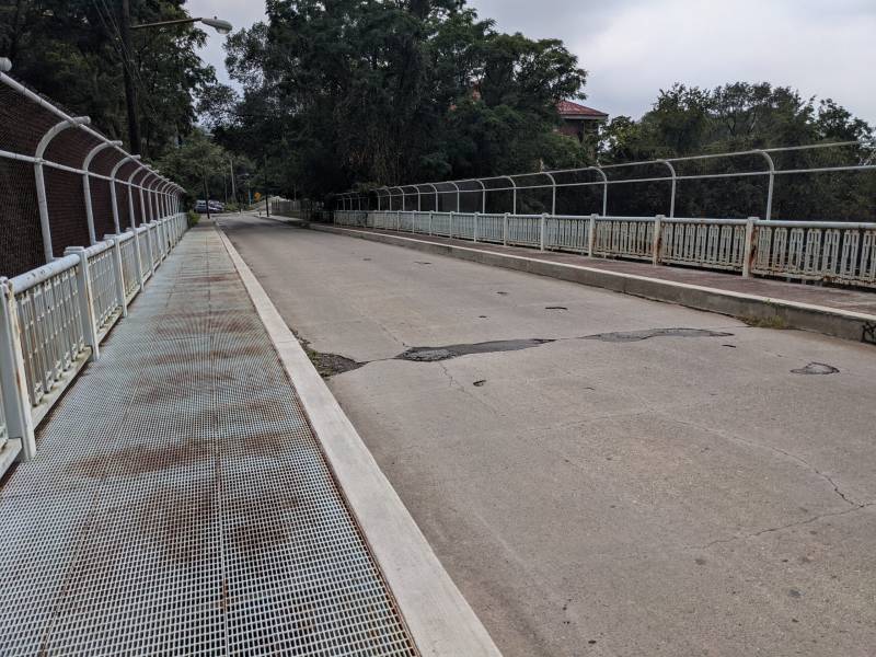
Make left. After the first bridge is the Mission St. pumping station circa 1900, which delivers water into the neighborhood and surrounding area. An initiative in 2009 brightened this area by replacing existing street lighting with higher wattage lamps. To continue to finish and Gold Route, cross the second bridge built in 1939 as a project of the Public Works Administration under FDR. That's South Side Park below and rising up the hill to your left. Continue to S. 18th St. and Mission St. Steps.
Make left. After the first bridge is the Mission St. pumping station circa 1900, which delivers water into the neighborhood and surrounding area. An initiative in 2009 brightened this area by replacing existing street lighting with higher wattage lamps. To continue to finish and Gold Route, cross the second bridge built in 1939 as a project of the Public Works Administration under FDR. That's South Side Park below and rising up the hill to your left. Continue to S. 18th St. and Mission St. Steps.
Make left. After the first bridge is the Mission St. pumping station circa 1900, which delivers water into the neighborhood and surrounding area. An initiative in 2009 brightened this area by replacing existing street lighting with higher wattage lamps. To continue to finish and Gold Route, cross the second bridge built in 1939 as a project of the Public Works Administration under FDR. That's South Side Park below and rising up the hill to your left. Continue to S. 18th St. and Mission St. Steps.

To join Gold Route, cross S. 18th St. to Pius St. For more information, please see West Route map and narrative.
To join Gold Route, cross S. 18th St. to Pius St. For more information, please see West Route map and narrative.
To join Gold Route, cross S. 18th St. to Pius St. For more information, please see West Route map and narrative.
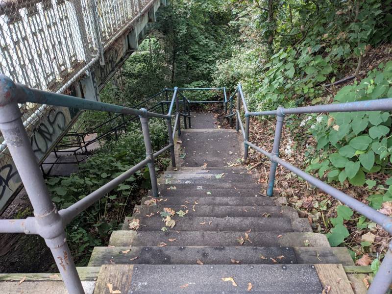
Mission St. Steps - Descend the steps behind the bus shelter on the left at S. 18th & Mission. These 102 steps drop down to S. 21st St. To return to the registration area, make a right at the bottom of the steps.
Mission St. Steps - Descend the steps behind the bus shelter on the left at S. 18th & Mission. These 102 steps drop down to S. 21st St. To return to the registration area, make a right at the bottom of the steps.
Mission St. Steps - Descend the steps behind the bus shelter on the left at S. 18th & Mission. These 102 steps drop down to S. 21st St. To return to the registration area, make a right at the bottom of the steps.
For Black/East Route text, click here.
